
Type
Civic Tech Platform
Industry
Disaster Risk Reduction
Platform
Web Application
Coverage
Philippines Nationwide
Price
Free to Use
AGOS Flood Risk Dashboard
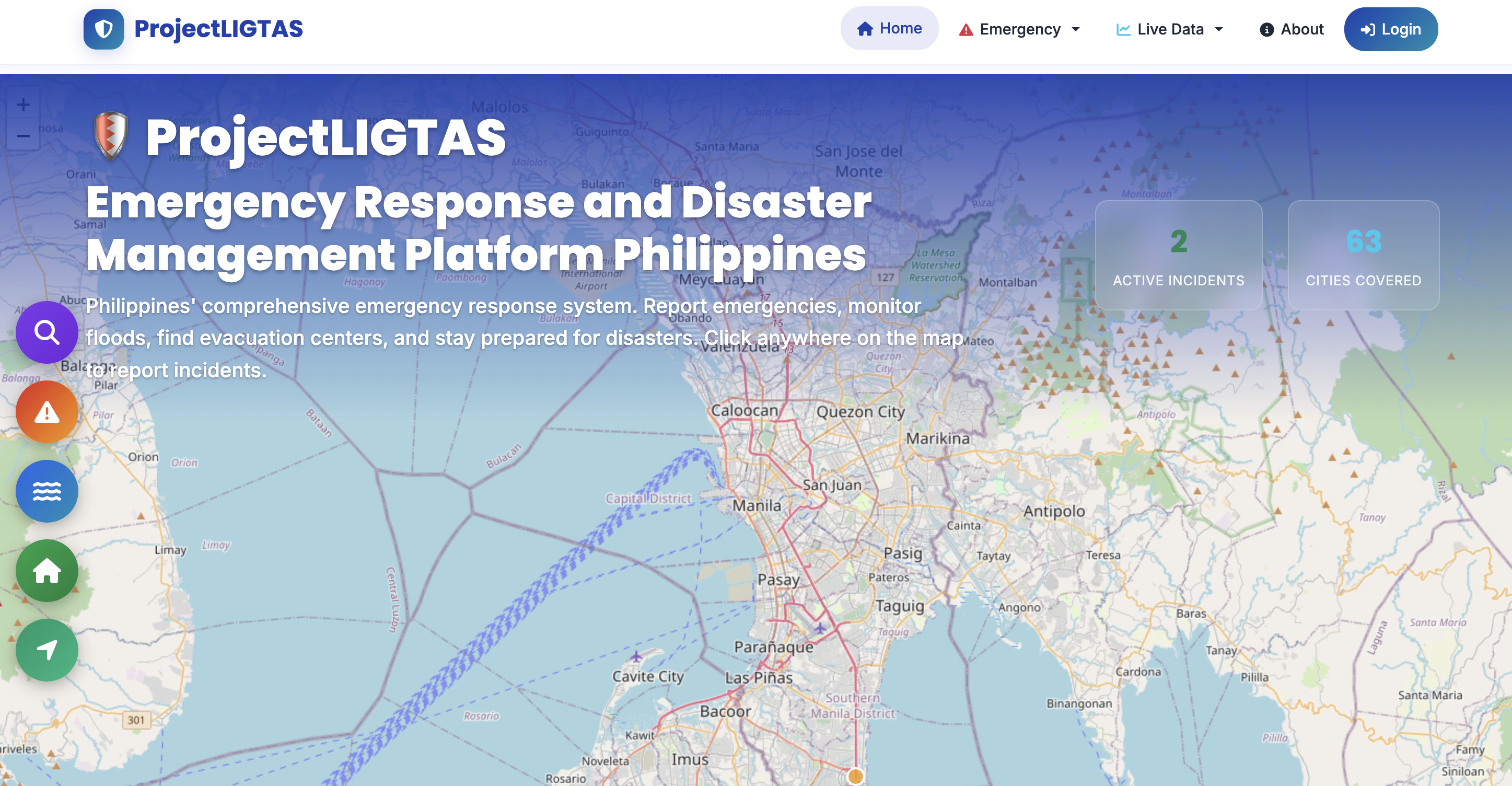
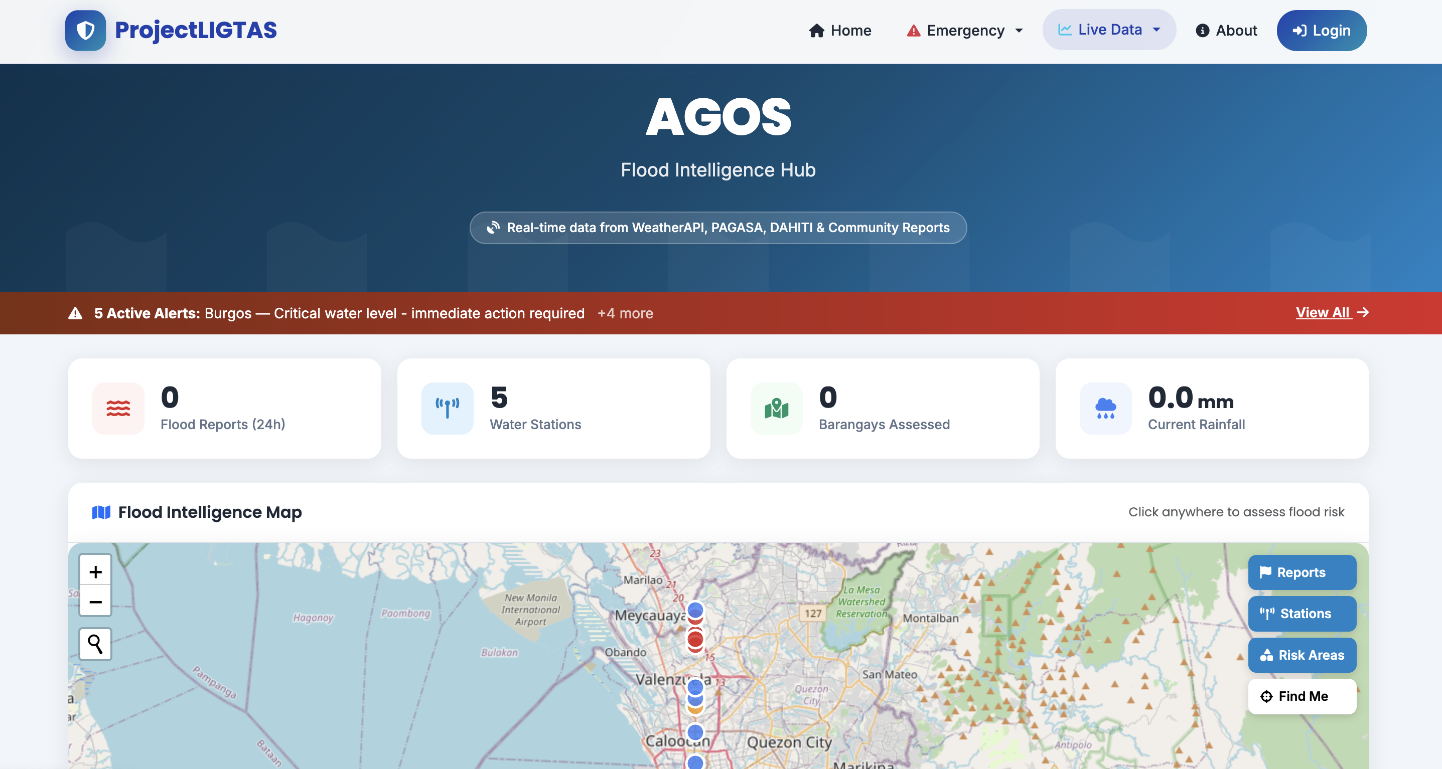
Hyperlocal flood risk visibility at the barangay level. AI-powered risk scoring aggregates weather data, terrain analysis, and historical flood patterns to generate predictive alerts before flooding hits.
Barangay-level risk scores updated in real time
AI aggregates weather, terrain, and historical flood data
Predictive alerts before flooding reaches your area
Coverage across 7,000+ Philippine barangays
Emergency Report System
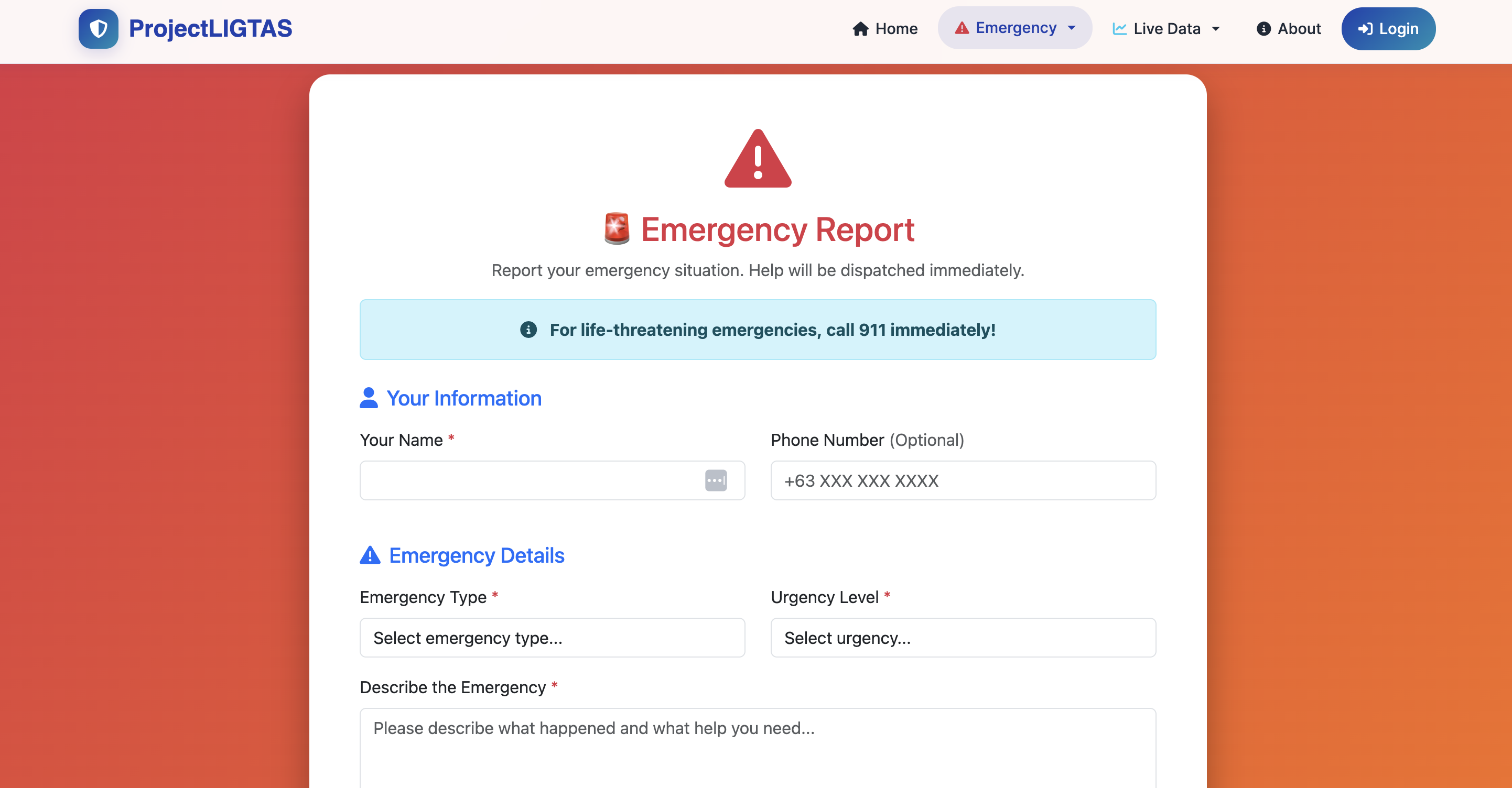
Enable citizens to submit real-time emergency reports with geolocation, photos, and situation details. Reports are aggregated for community-level awareness and disaster response coordination.
Geotagged reports pinned to live community map
Photo and situation detail submission
Aggregated into LGU and responder dashboards
Works on any mobile browser — no app install needed
Flood Report Submission
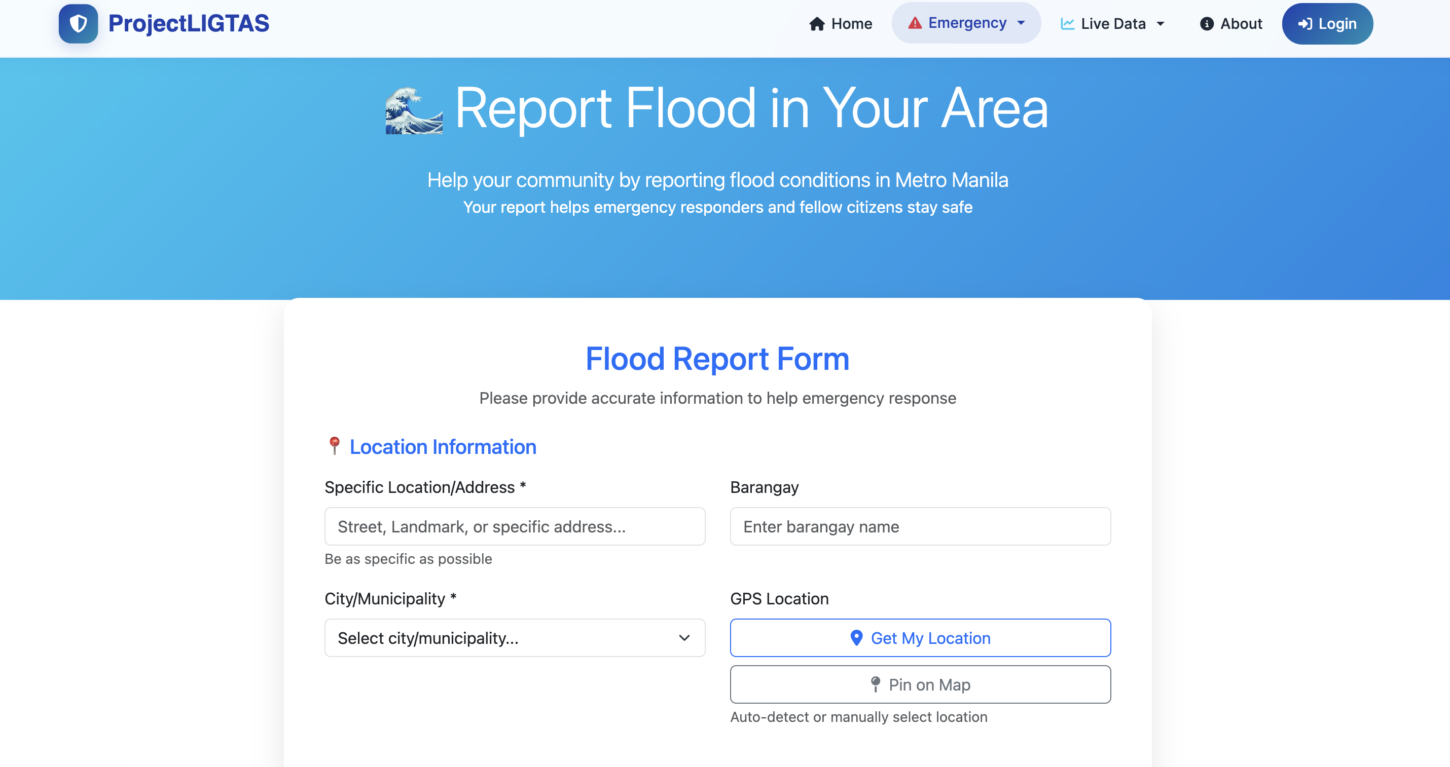
Crowdsourced flood reporting allows communities to document flooding events with water level estimates, affected areas, and visual evidence — building a live picture of conditions on the ground.
Water level estimates per street and barangay
Photo evidence with timestamps
Reports verified and weighted by AI scoring
Builds historical flood pattern database over time
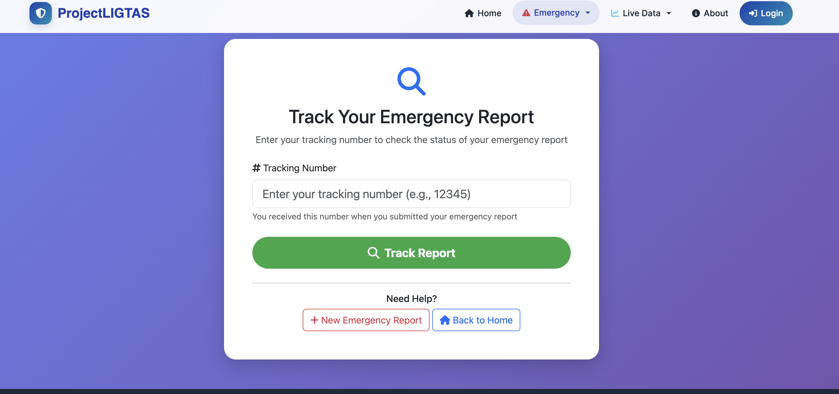
Track Your Report
Citizens can follow up on submitted reports in real time — see status updates, responder activity, and resolution confirmations. Closes the loop between community reporters and disaster response teams.
Live status tracking: Submitted → Reviewed → Resolved
Report reference code for easy lookup
Admin notes and resolution updates visible to reporter
No account required to track your submission
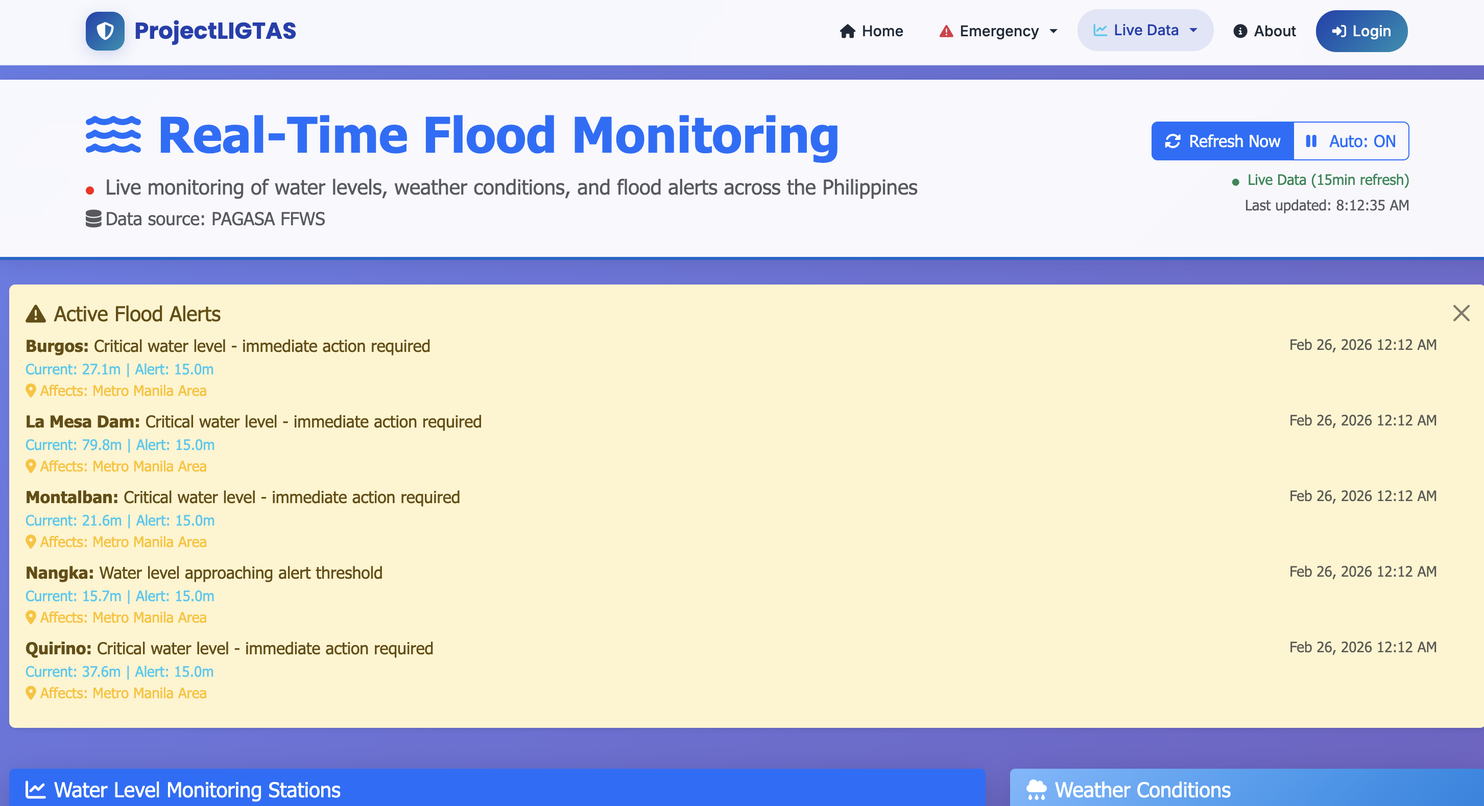
Real-Time Monitoring
Live monitoring dashboard aggregating weather feeds, flood sensor data, and community reports into a unified view. Track conditions across multiple barangays simultaneously from one screen.
Unified view: weather + sensors + community reports
Multi-barangay monitoring on a single dashboard
Live data refreshed without page reload
Designed for LGU command centers and DRRM offices
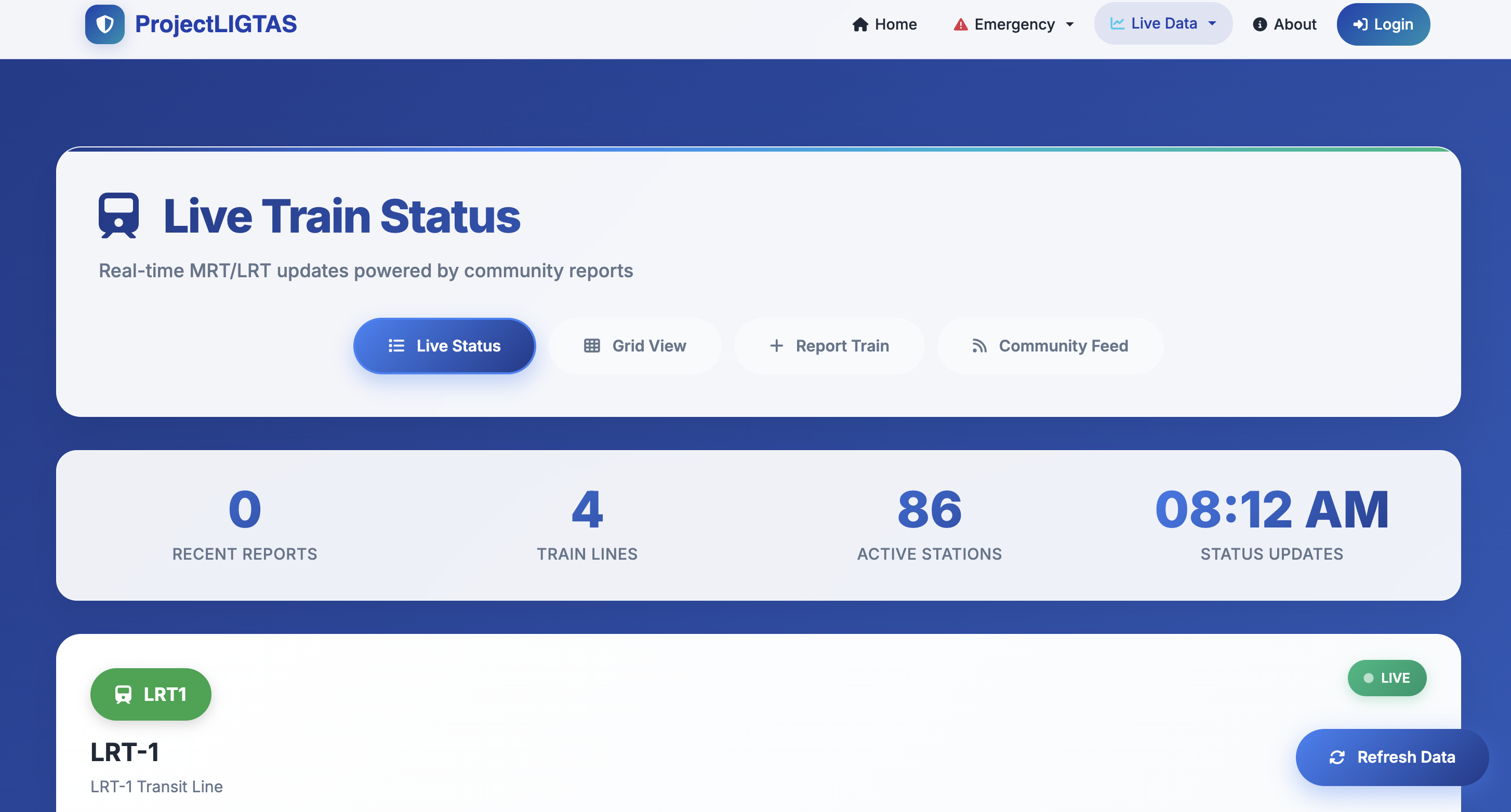
Train Status Tracking
Route-aware commute monitoring for Filipino commuters. Track MRT/LRT/PNR line status, delays, and service disruptions caused by weather events to plan safer routes during typhoons and floods.
MRT, LRT, and PNR line status at a glance
Weather-triggered disruption alerts
Safe route recommendations during active floods
Helps commuters make informed decisions before leaving home
AI Risk Assistant
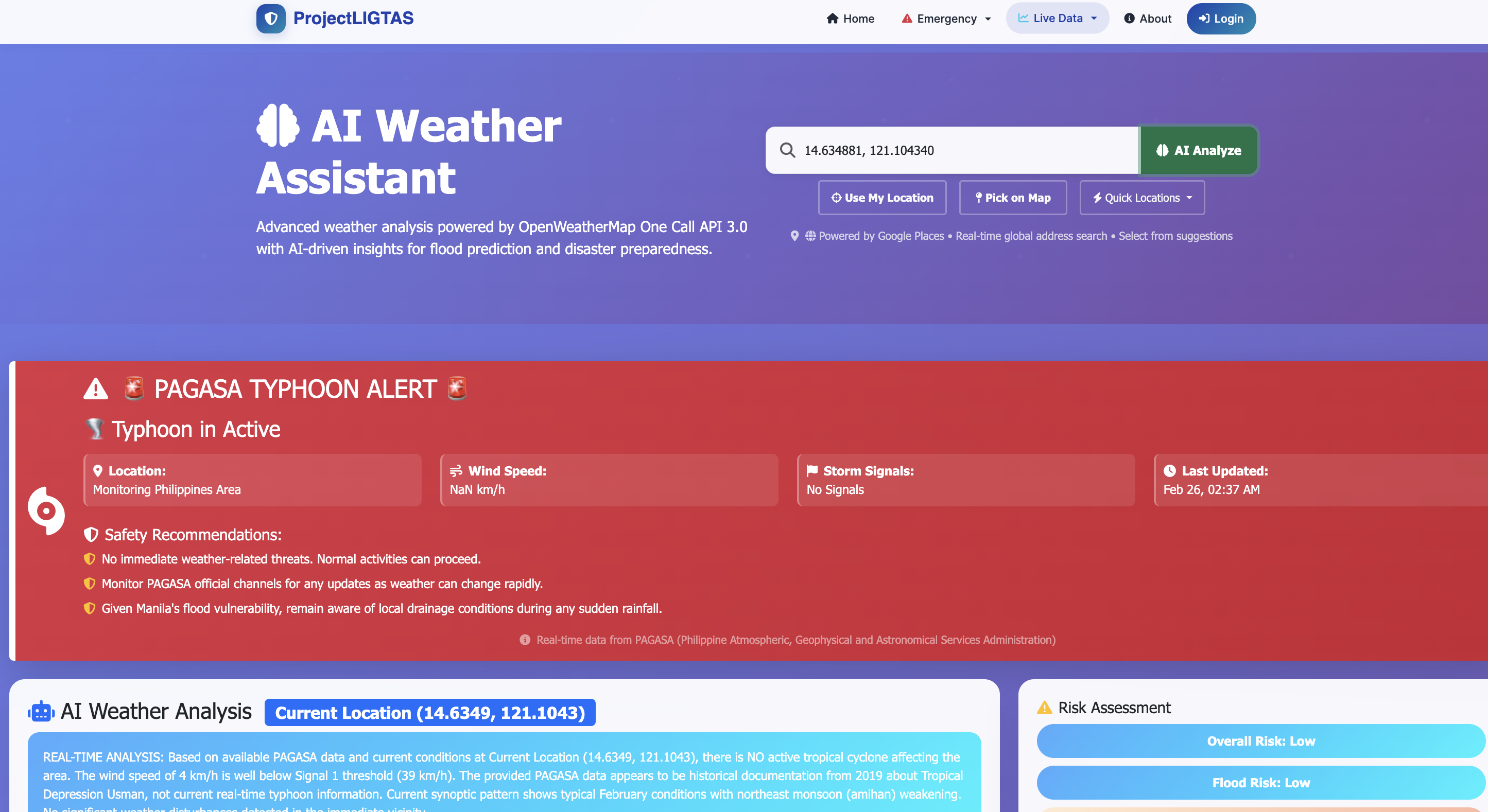
Conversational AI that answers flood risk questions in plain Filipino or English. Ask about your barangay, get safety checklists, evacuation routes, and disaster preparedness guidance on demand.
Answers flood risk questions in Filipino and English
Personalized safety checklists per barangay
Evacuation route guidance and shelter recommendations
AI-scored risk assessments for your specific location
Built With Proven Technologies
Want Disaster Intelligence for Your LGU?
ProjectLIGTAS is built to protect Filipino communities. Contact us to learn more about deploying disaster intelligence for your LGU or organization.
John from California
just requested a quote
2 minutes ago