
Project Overview
ProjectLIGTAS is a Philippine-focused flood risk prediction and disaster intelligence platform created as a mission-driven civic technology initiative by DevWithZach.
The platform provides hyperlocal flood risk visibility, barangay-level disaster intelligence, route-aware commute monitoring, community-powered incident reporting, and AI-assisted predictive scoring — all accessible through a modern, responsive web platform designed for both desktop and mobile use.
This is not a client project.
This is a self-initiated civic tech platform personally conceptualized, architected, and developed under DevWithZach — demonstrating how engineering expertise can be applied beyond commercial SaaS into civic impact.
The Problem
The Philippines is one of the most disaster-prone countries in the world. Filipino communities face compounding challenges that existing systems fail to address at the local level:
Critical Gaps:
- Frequent typhoons - The Philippines averages 20+ typhoons per year, causing widespread flooding and displacement
- Urban flooding - Rapid urbanization has worsened drainage capacity, making metro areas increasingly vulnerable
- Climate-driven rainfall volatility - Unpredictable weather patterns make traditional forecasting insufficient
- Limited hyperlocal risk awareness - Existing systems provide regional advisories, not barangay-level intelligence
- Delayed public hazard communication - Communities learn about flood risks too late to take preventive action
Most public systems rely on static advisories. Communities need dynamic, location-based intelligence. ProjectLIGTAS was built to bridge that gap.
The Solution
ProjectLIGTAS combines interactive mapping systems, location-based flood risk scoring, barangay-level environmental risk indicators, real-time incident feeds, and predictive risk modeling logic into a single accessible platform.
Core Platform Features
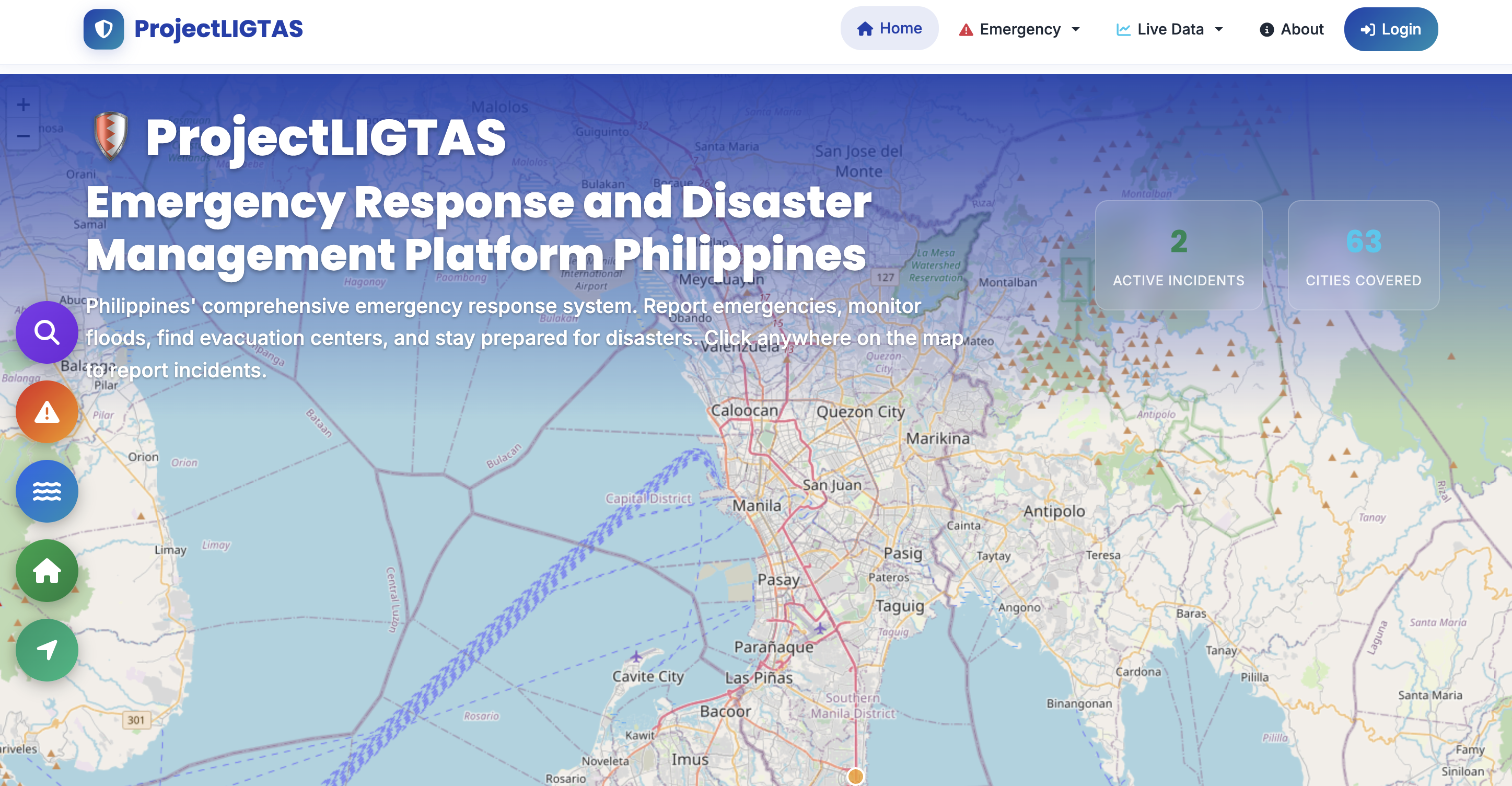
Interactive Flood Risk Map
- Pin your exact location anywhere in the Philippines
- View flood risk scoring instantly
- Overlay hazard indicators
- Built on scalable Leaflet-based map architecture
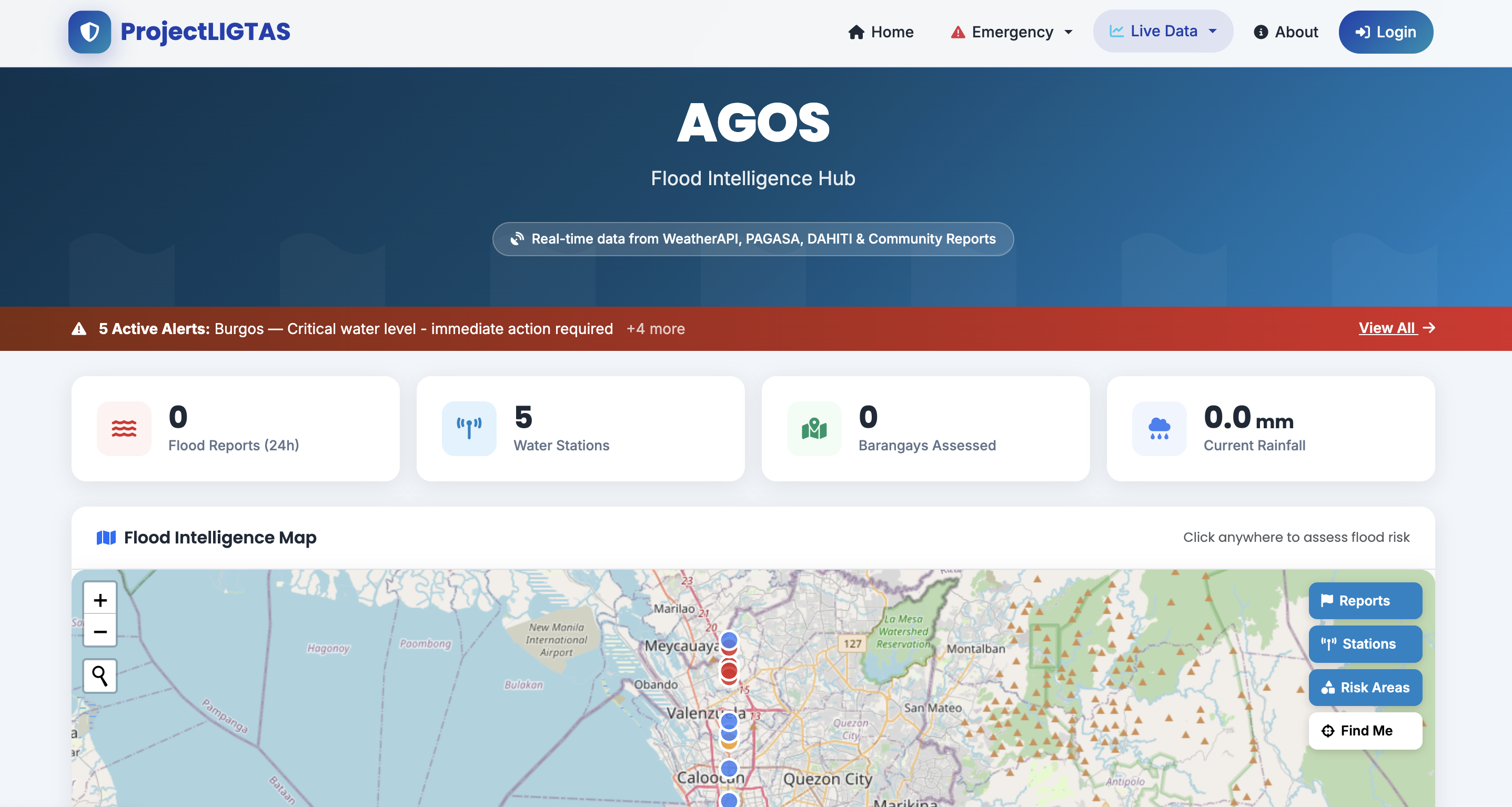
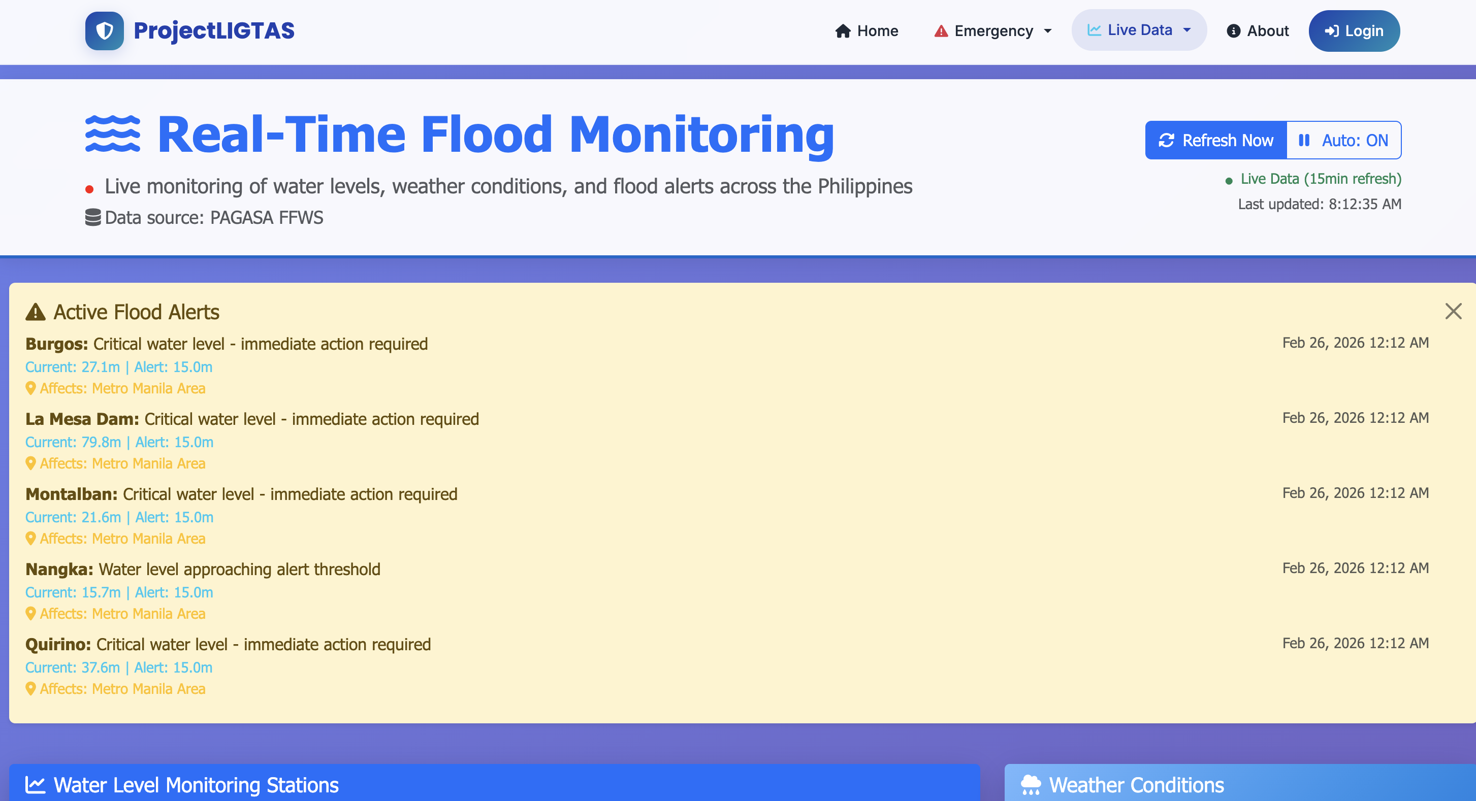
Barangay-Level Risk Intelligence
- Flood risk score per barangay
- Environmental risk factors analysis
- Historical flood context data
- Predictive scoring adjustments
Commute Monitoring System
- Route-based risk visualization
- Grid-based hazard mapping
- Feed-based incident updates
- Flood-aware navigation intelligence
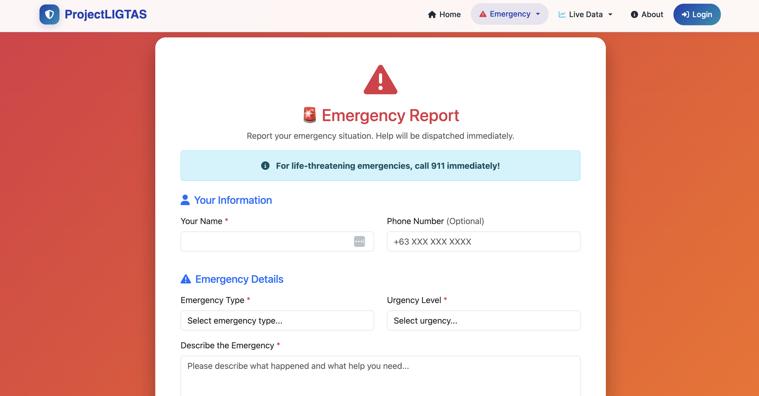
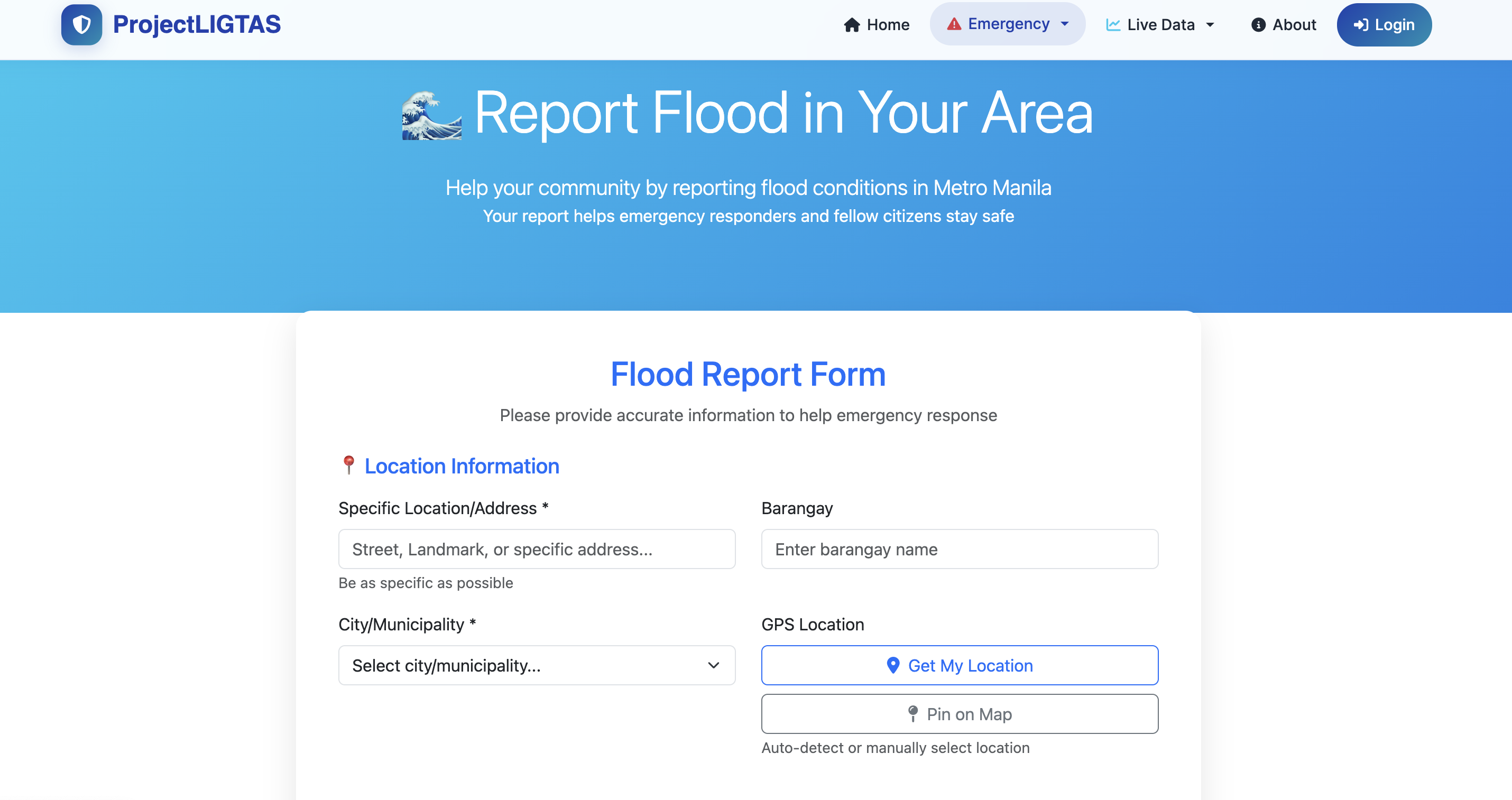
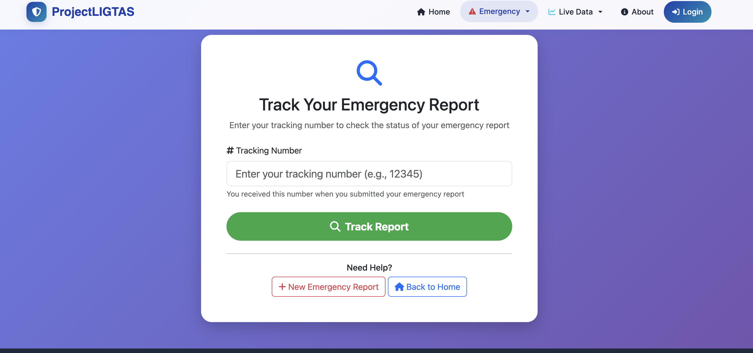
Community Reporting System
- Citizens submit flood reports
- Ground-level environmental conditions
- Real-time hazard updates
- Civic participation meets data intelligence
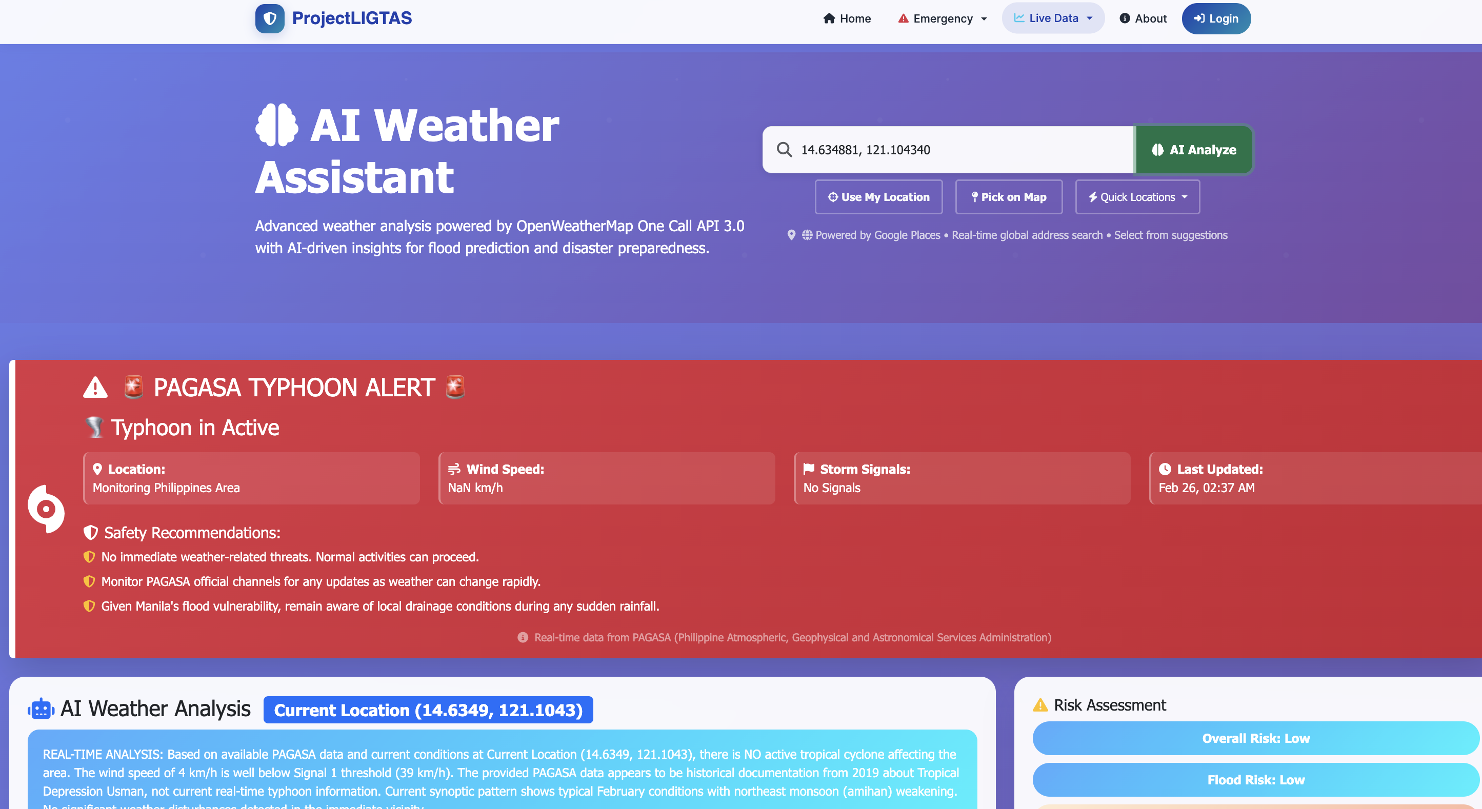
AI-Based Risk Prediction
- Environmental data modeling
- Location-weighted scoring
- Risk category segmentation
- Predictive adjustment algorithms
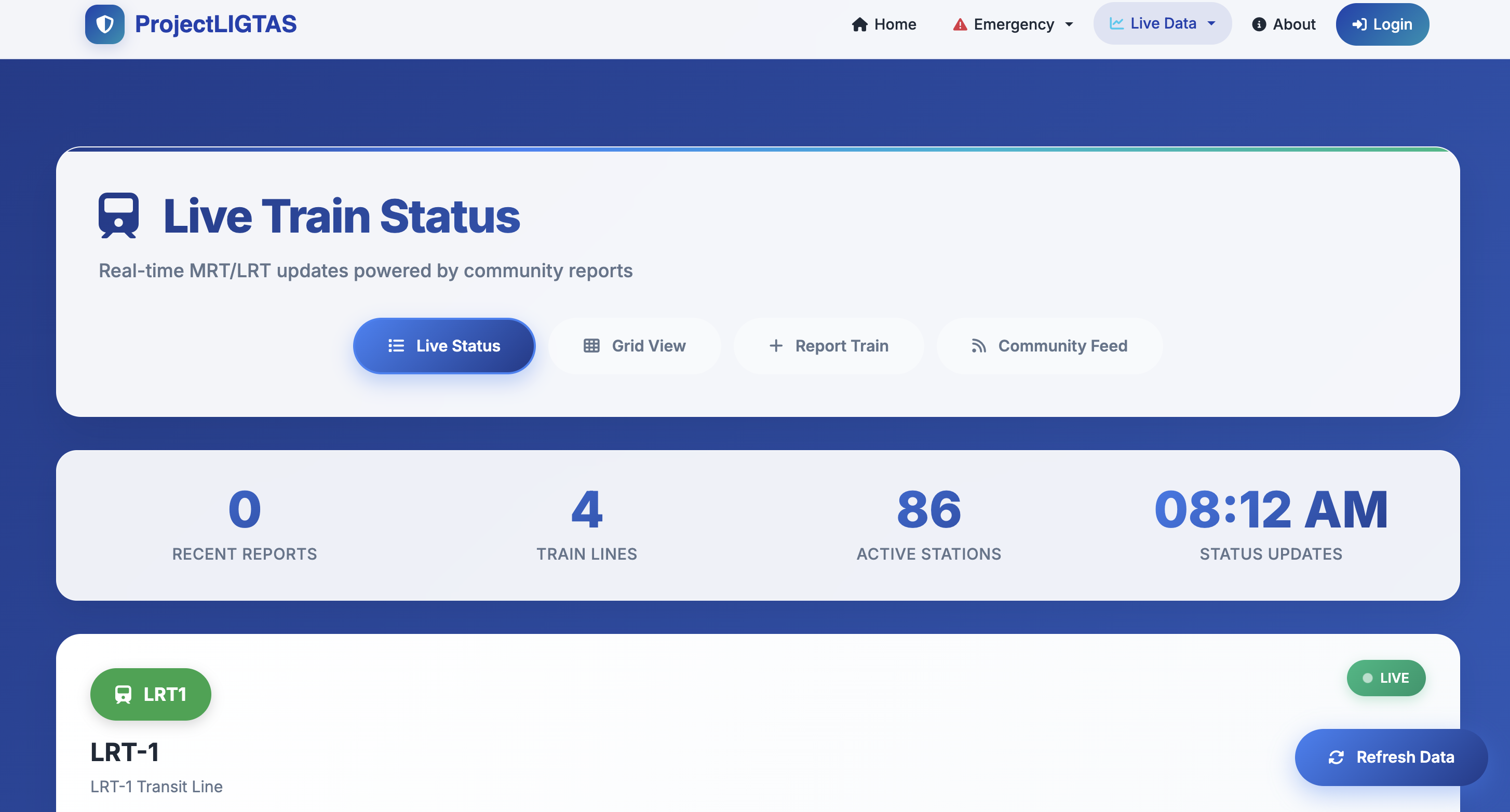
Transit Status Tracking
- Real-time train status monitoring
- Transit disruption alerts
- Weather-affected route updates
- Commuter safety intelligence
Development Scope
Technical Architecture
ProjectLIGTAS is built on a modular architecture designed for future integration with rainfall APIs, government datasets, IoT flood sensors, satellite imagery, and SMS alert systems.
Civic Impact
AI
Predictive Scoring
7K+
Barangay Coverage
Live
Real-Time Feeds
PH
Nationwide
- Reduces flood-related accidents: By providing real-time, location-specific flood risk intelligence, communities can make informed decisions before and during weather events
- Improves disaster preparedness: Barangay-level risk scoring allows LGUs and citizens to prepare proactively rather than react to static advisories
- Supports barangay-level awareness: Hyperlocal intelligence provides the granularity that national-level systems cannot, serving the communities that need it most
- Provides digital tools for LGUs: Local government units gain access to data-driven flood intelligence to support disaster response planning
- Empowers citizens with accessible hazard data: Transforms disaster awareness from static announcements into interactive, data-driven intelligence anyone can use
Why This Project Matters
ProjectLIGTAS transforms disaster awareness from static announcements into interactive, data-driven intelligence. As a self-initiated civic technology initiative, it represents a commitment to technology for public good:
-
Use software engineering for public safety
The same engineering discipline used in commercial SaaS is applied here to solve a life-and-safety problem affecting millions of Filipinos during typhoon season.
-
Build scalable local disaster intelligence tools
The modular architecture is designed to integrate with rainfall APIs, IoT flood sensors, satellite imagery, and SMS alert systems as the platform evolves.
-
Support climate resilience in the Philippines
By providing accessible, data-driven flood intelligence at the barangay level, ProjectLIGTAS contributes to building more resilient Filipino communities.
-
Demonstrate how local innovation can solve local problems
ProjectLIGTAS proves that impactful civic technology doesn't require foreign-built solutions — Filipino engineering talent can build world-class platforms for Filipino communities.
Future Expansion Vision
Real-time Rainfall API
Live weather data integration for dynamic risk scoring
IoT Flood Sensors
Sensor data ingestion for ground-truth water level monitoring
LGU Admin Dashboards
Administrative tools for local government disaster response teams
SMS Alert System
Text-based flood warnings for communities without internet access
PWA Deployment
Progressive Web App for offline-capable mobile access
Enhanced AI Scoring
Advanced predictive models with machine learning capabilities
ProjectLIGTAS is a fully self-initiated platform built from concept to deployment — demonstrating how engineering expertise can be applied beyond commercial SaaS into civic impact. It represents what's possible when Filipino tech talent focuses on solving local problems with world-class engineering.
John from California
just requested a quote
2 minutes ago